
Replacing a 16-year-old map with a production-grade GIS product
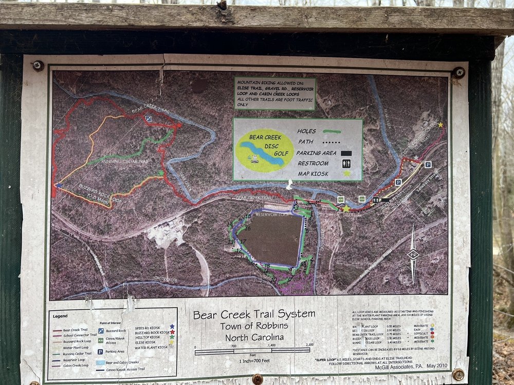
The Bear Creek Trail System in Robbins has been operating without an updated cartographic product since the original trailhead kiosk map was produced by a local engineering firm in May 2010. That map served trailhead visitors well but lacked machine-readable data and did not reflect current trail use designations including mountain biking on designated routes.
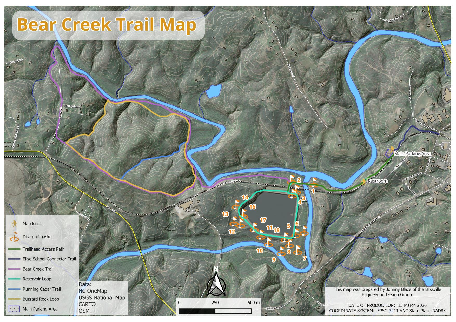
Moore Energy & Mapping produced a modernized trail map and supporting GIS dataset using professional open-source GIS workflows: trail geometry sourced from OpenStreetMap via the Overpass API and supplemented with on-screen digitizing; hillshade and elevation data from the USGS National Map; and base imagery from NC OneMap and CARTO. All data is authored in EPSG:32119 (NC State Plane NAD83) with trail lengths calculated in miles.
The disc golf course — an 18-hole layout arranged around the central reservoir — is documented with individual basket locations, hole distances, tee type designations, and par values sourced from on-site measurement and Parks and Recreation records.
Trail routes and permitted uses
| Trail name | Map color | Permitted use | Est. distance | Character |
|---|---|---|---|---|
| Bear Creek Trail | ■ Magenta | Hiking | ~3.75 mi | Main spine trail along Bear Creek corridor |
| Buzzard Rock Loop | ■ Yellow | Hiking | 10.8 mi | Longest loop — western ridgeline, significant elevation change |
| Running Cedar Trail | ■ Blue | Hiking | ~1.4 mi | Northwest connector through upland pine/cedar |
| Reservoir Loop | ■ Teal | Hiking + MTB | ~1.5 mi | Circumnavigates the central reservoir and disc golf course |
| Elise School Connector | ■ Dark blue | Hiking + MTB | ~0.5 mi | Eastern connector from Elise School parking area |
| Cabin Creek Loop | ■ Blue (S) | Hiking + MTB | ~2.5 mi | Southern drainage corridor along Cabin Creek |
| Trailhead Access Path | ■ Green | All uses | ~0.2 mi | Paved/hardened connection from main parking area |
DISTANCES ARE APPROXIMATE — CALCULATED IN EPSG:32119 FROM OSM GEOMETRY WITH ON-SCREEN DIGITIZING SUPPLEMENT. FIELD VERIFICATION RECOMMENDED FOR PUBLISHED MILEAGE.
18-hole course details
The Bear Creek Disc Golf Course occupies the reservoir peninsula and surrounding grounds, with 18 holes arranged at varying orientations and distances. Two holes (12 and 16A) play as Par 4. Course par total: 56. Tee designations: S = Short, L = Long, X = Extended.
Map products and GIS data
All Bear Creek Trail System products are publicly accessible. The KMZ superoverlay is optimized for Google Earth Pro and will drape the full map across 329 terrain-aligned tiles at zoom level 17 — the most detailed available for this area.
Bear Creek Trail System — Product Set
Print-ready map, terrain-draped KMZ, and attributed vector GIS data in NC State Plane NAD83.
Data sources and methods
Data credits: OpenStreetMap contributors (ODbL), NC OneMap, USGS National Map, CARTO. Trail distances calculated in EPSG:32119 from digitized geometry. Ground-truth verification of select features recommended before use in signage or official publications.